Thursday, March 10, 2011
Whitianga and the Coromandel Peninsula
We were glad the kind NZ folks aboard Evening Star had offered us their mooring right off the Whitianga Harbour. Whitianga is a nice town and we enjoyed strolling through the shops and sipping over-priced coffee. We did some provisioning in the stores and toured the local museum. Emily got to try her hand at bone carving and did a nice job on her fish hook. The fish hook is called Hei Matau in Miori and (among other things) signifies safe passage over water which we can always use more of. We had the "school" to ourselves and the owner even explained to us how to do it straight from the cow bone. We now have a couple of cow bones drying aboard Emily Grace and will add bone carving to future craft days at the Lawler Academy of the High Seas.
The current was screaming past our mooring at 3 to 4 knots and I would have felt uncomfortable leaving the boat on anchor with these swift tides changing direction every 6 hours. As it was, we rented a car and had a whirlwind couple of days. The first evening we drove to Thames, a town on the southwestern corner of the Coromandel Peninsula and had dinner at a fish and chips place overlooking the Firth of Thames (bay). We drove up along the west coast to Coromandel town and enjoyed the views and NOT WALKING. We just made it back to the boat at sunset and rested up for the busy day ahead.
We started the next day with a visit to the Twin Oaks Ranch and Emily and I enjoyed a 2 hour horseback ride. Kim still had the painful memories of bareback riding in Tonga and opted out of this ride. The trek took us over expansive farmland, through beautiful native bush and streams and included a stop at a waterfall. We saw breath-taking views of Mercury Bay, Matarangi, Whangapoua, Great Barrier Island and the Pacific Ocean. My horse was well behaved and we were allowed to move off the trails a bit since it was just Emily, the guide and I. Emily did take one tumble as we charged up a hill, but was back in the saddle in a flash and nothing but her pride was damaged.
The car then took us to Coromandel town where we had lunch and found the Driving Creek Railway. Track laying began in 1975 by Barry Brickell shortly after he established a pottery workshop on land he purchased in 1973. As a railway enthusiast, he saw the practical and environmental advantages of having a narrow-gauge railway system through his rugged scrub-covered land to give all weather access to clay and pine wood kiln fuel. Brickell worked for 15 years and poured a considerable amount of money into railway construction before it was licensed to carry fare-paying public in 1990. The 1 hour round trip on the train took us through replanted native kauri forest and included 2 spirals, 3 short tunnels, 5 reversing points and several large viaducts as it climbed up to the mountain-top terminus. They called the building at the top the "Eyefull Tower" and it did offer great views out over the island-studded Hauraki Gulf with the forested valley and mountains behind.
We zipped back east across the peninsula and saw where Captain Cook observed the transit of Mercury and then to Hot Water Beach. We had read about Hot Water Beach and had to see it for ourselves. Volcanic vents bring hot fresh water up under the sand right on the white sand beach. When the tide is high, the hot water mixes with the cold seawater and is barely noticeable. However, low tide is when to come and we timed our arrival along with about 100 other crazy people. Whole families come with shovels and dug Jacuzzi-sized holes in the beach. The hole fills with 120 degree water and just before it becomes unbearable, a waves washes in with 65 degree water to cool it down. The wave recedes and the Jacuzzi heats up until the next wave. Much fun and Emily almost burnt a tender foot.
Exhausted, we turned in the rental car and slept soundly aboard Emily Grace wondering what we will find next as we continue to explore the Hauraki Gulf.
Tom
Tuesday, March 8, 2011
Great Mercury Island & Captain Cook
We left Great Barrier Island and made the mistake of going through the Coville Channel to Great Mercury Island with the tide opposing about 25 knots of wind. This thin bit of sea between Great Barrier and the Coromandel peninsula has swift currents and is known for its rough seas. We had steep waves, a sick captain and a salty boat upon arrival.
Most of Great Mercury Island is owned by a few very wealthy people and we anchored and used moorings right off their mansions and enjoyed "borrowing" their internet. We watched helicopters and beautiful motor launches come and go.
We did go ashore and hiked around to see the sheep, cows and horses and the sweeping views. Emily loved running up and down the green hills and peering over the vistas.
We headed south into Mercury Bay and passed Cooks Bay into Whitianga. You guessed it, more captain Cook. Captain Cook and astronomer Charles Green observed the transit of Mercury at Te Whanganui-a-hei (Mercury Bay) on the Coromandel Peninsula. On the way we passed Needle Rock. Even with my old eyes, I could thread a needle through that hole!
The inner planets, Mercury and Venus, occasionally pass across the Sun and can be observed as small black dots. Timing these 'transits' from different locations on Earth was the first accurate method of determining our distance from the Sun.
Captain James Cook and his expedition members had recently been in Tahiti to observe the transit of Venus, and were now on a mission to search for the rumoured 'Great Southern Continent'. When stormy seas caused damage to the Endeavour, Cook turned his course towards the land discovered by Dutch seafarer Abel Tasman in 1642. On 6 October 1769, Nicholas Young the cabin boy spotted the East Coast of the North Island.
Over the next few months Cook mapped the entire coastline, providing the first-ever 'outline' of New Zealand - and establishing that it was not the Great Southern Continent. His charts proved so accurate that some were still being used in the 20th century.
Much of Cook's surveying was done from offshore, but as 9 November approached he sought solid ground from which to observe the transit of Mercury. The observation was made using the cutting-edge technology of the time, a sextant (invented in 1757). Cook was accompanied by Charles Green, the Royal Society expedition astronomer who died on the homeward journey in 1771.
From Cooks journal - "my reasons for putting in here were the hopes of discerning a good harbour and the desire I had of being in some convenient place to observe the Transit of Mercury, which happens on the 9th instant and will be wholly visible here if the day is clear between 5 and 6 o'clock." Cook also named the Whitianga Harbour "River of Mangroves" and this area is still referred to as "The River".
The sighting of the Transit of Mercury is commemorated on Cooks Beach by a cairn of Coromandel granite which tells the story ; "In this bay was anchored 5 Nov 1769, HMS Endeavour, Lieutenant James Cook RN, Commander. He observed the transit of Mercury and named this bay."
The next transit of Mercury that will be fully visible from New Zealand will occur in 2052.
Tom
Most of Great Mercury Island is owned by a few very wealthy people and we anchored and used moorings right off their mansions and enjoyed "borrowing" their internet. We watched helicopters and beautiful motor launches come and go.
We did go ashore and hiked around to see the sheep, cows and horses and the sweeping views. Emily loved running up and down the green hills and peering over the vistas.
We headed south into Mercury Bay and passed Cooks Bay into Whitianga. You guessed it, more captain Cook. Captain Cook and astronomer Charles Green observed the transit of Mercury at Te Whanganui-a-hei (Mercury Bay) on the Coromandel Peninsula. On the way we passed Needle Rock. Even with my old eyes, I could thread a needle through that hole!
The inner planets, Mercury and Venus, occasionally pass across the Sun and can be observed as small black dots. Timing these 'transits' from different locations on Earth was the first accurate method of determining our distance from the Sun.
Captain James Cook and his expedition members had recently been in Tahiti to observe the transit of Venus, and were now on a mission to search for the rumoured 'Great Southern Continent'. When stormy seas caused damage to the Endeavour, Cook turned his course towards the land discovered by Dutch seafarer Abel Tasman in 1642. On 6 October 1769, Nicholas Young the cabin boy spotted the East Coast of the North Island.
Over the next few months Cook mapped the entire coastline, providing the first-ever 'outline' of New Zealand - and establishing that it was not the Great Southern Continent. His charts proved so accurate that some were still being used in the 20th century.
Much of Cook's surveying was done from offshore, but as 9 November approached he sought solid ground from which to observe the transit of Mercury. The observation was made using the cutting-edge technology of the time, a sextant (invented in 1757). Cook was accompanied by Charles Green, the Royal Society expedition astronomer who died on the homeward journey in 1771.
| Cooks Bay |
The sighting of the Transit of Mercury is commemorated on Cooks Beach by a cairn of Coromandel granite which tells the story ; "In this bay was anchored 5 Nov 1769, HMS Endeavour, Lieutenant James Cook RN, Commander. He observed the transit of Mercury and named this bay."
| The Cook Monument |
Tom
Monday, February 14, 2011
Great Barrier Island
We left Whangarei in relatively calm seas with hopes to spend a night at the Mokohinau Island group. I had heard the diving here was good, but too many weeks at a dock spoiled us for calm waters and it was way too rolly here. We moved on and comfortably anchored inside Port Fitzroy bay before dark.
We stayed here for a few lazy days. We hiked up Old Lady trail for sweeping views of the harbor and got Emily’s new inflatable kayak blown up and in the water. She loves it and with a small bottom-keel, it tracks OK for an inflatable.
They had a nice general store there to buy essentials like fresh cream for morning coffee. We were anchored behind some small islands that were covered with oysters. The first day we gathered a couple dozen and put them on the grill until they poached open. They were very good. The next day, Emily and I took the kayaks to the island with a small hammer and an oyster knife. She and I sat on the rocks for about an hour eating one after another. Emily would find a big one and knock it off the rock with the hammer and Dad would shuck it. I lost count at about 30 that slid down my throat and Emily ate more than a dozen. They were raw, cold and delicious and I can’t imagine how they could be fresher.
We moved across the sheltered Port Fitzroy bay to Smokehouse bay for a few nights. What a treat that was. They had built a house complete with inside bath and showers fed by fresh water mountain streams. They had a wood stove that would heat about 200 gallons of water to supply steaming baths and even had another tub under the stars. They had wash tubs for doing laundry, hand wringers, and several clothes trees on which to hang the laundry to dry. Clothes pins, pots and pans for cooking, racks and a smokehouse for smoking fish, picnic tables and 3 rope swings for the kids were all provided. We met some friends that we had met in Opua and they invited Tom to go with them on SCUBA for lobsters (they call them Crayfish here). We dove for about and hour and although Tom only saw small ones, one of the other chaps bagged one and decided that we should keep it for dinner. The Kiwis have all been very nice to us.
We moved to another protected bay called Kiwiriki and there we did some more kayaking and I dragged Emily behind the dingy in our new tow toy. She was a little nervous at first but soon she couldn’t get enough of hopping the wake. I tried SCUBA here for lobster on my own and had no luck.
We moved out of Port Fitzroy bay and around to explore some of the southern anchorages. Again, I stopped near some lobster pots on the way and saw no lobsters here as well. We tucked into Whangaparapara Bay. From here we took a 4 hour hike to hot springs where we had knee deep 110 degree water up to our knees. There are copper mines here and many of the rocks were colored verdigris green. There was the typical sulfur smell that Emily did not care for but seeing the bubbles rising from the vents was pretty neat to see. They had a sign posted that warned not to put your head under the water because an amoebic meningitis could swim up your nose and kill you. We did not linger too long there.
The trails were well maintained with bridges over most of the streams and benches and picnic tables here and there. We saw many birds along the trails, waterfalls and the sound of Cicadas in the trees was almost deafening.
We had a nice lunch at the Great Barrier lodge and met a local man that was to be married the next day. He was delivering lobsters and scallops that he had gathered himself for the reception. He told me where in another bay to look for scallops. The next day, I followed his tip and dropped the hook in 50 feet of water in Blind bay. It took me longer to don the SCUBA gear than it did to gather 58 scallops. They littered the bottom and I only went about 15 feet around the anchor to bag my limit. We loaded them aboard and moved again to Tryphena Harbor. We tucked behind a sheltered point. The scallops each have a small orange roe sack that was only slightly briney. The white scallops were tender and melted in your mouth. We sampled a few raw with some hot chutney and had a lovely scallop casserole for dinner with the rest.
They have a nice ferry dock near our anchorage, but the main town and restaurant were a good 1 ½ hour walk around several bays and over a small hill. We enjoyed lunch in a cafĂ© and then trekked home. We will stay here a few days wanting for calmer waves to head south east toward Mercury Island.
Tom
Saturday, January 15, 2011
2010 Reflections
Time here at the dock in Whangarei, New Zealand is keeping us busy completing projects that were impossible to do in the undeveloped areas we covered over the last year. Each day we whittle away at the work list and some items get completed and others get added. We are reading books, enjoying shared dinners on the dock with friends and skipping school on some days. We have managed to get away and see live Kiwi birds, glow worms in caves and several impressive waterfalls. We saw stout traps on many of the trails to eliminate these rodents that eat kiwi eggs.
But caught up in the daily “what do we do next?” mentality, we sometimes forget to pause and reflect on what we have accomplished. Below are some pictures of the local area and some of the captain's recollections.
One year ago, we were still in the Caribbean Sea winding our way among the Kuna Indians in the beautiful San Blas islands. Our first 400 (nautical) miles in 2010 took us around these islands over to Panama and through the mighty Panama canal to the Perlas Islands. The boat log read 1200 miles as we made land fall in the Galapagos Islands and swam with sea lions and stalked giant tortoises, swimming iguanas and flying blue-footed booby birds. After 21 days at sea and 4200 miles, we where surrounded by the majestic volcanic pillars guarding the paradise in Fatu Hiva, French Polynesia.
We rolled passed 5000 miles as we drifted among the atolls of the Tuamotus and swam with sharks and manta rays and traded for black pearls. 5400 miles had us through Tahiti, all of the Society Islands and Bora Bora was at our transom as we powered west. At 6000 miles, we were as remote as we would get. We entered Suwarrow and spent 2 weeks as guests of James and Appii, the Cook Island rangers that were stationed there. We hunted for coconut crabs and speared fish each day and shared dinners with them and our other cruiser friends. American Samoa marked the 6500 mile mark as we gathered boat parts, attended Rotary meetings and were befriended by Penitani and his family. We saw Robert Robert Louis Stevenson's home in (Western) Samoa, drank Kava for the first time and had front row seats for the 50-man canoe races as 6700 miles rolled by.
6800 miles had us building a Red-Cross home in Niuatoputapu for a 70 year old Tongan man that had lost his home in a tsunami. There we dined on suckling pig and rode horses on the beach. 7200 miles had us cruising in the company of whales past the Vava’u and Ha’apai groups and in Nuka’alofa we were guests of Big Mama.
After 8300 miles, we had finally crossed the Pacific Ocean and had landed in Opua, New Zealand. There we suffered culture shock as we strolled through the stores and gazed at floor-to-ceiling shelves of STUFF!
After another 200 miles cruising the Bay of Islands and working our way down to Whangarei, our boat log stands at 8500 miles for 2010. That would be like walking from New York to San Francisco almost 4 times. And frankly, that makes me tired just thinking about it. My trip was less tiring and I did almost all of it barefoot!
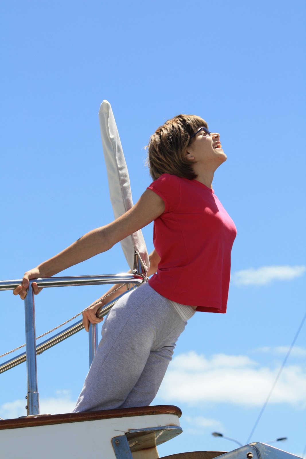
What is more important than the miles is that our crew has worked together through some trials and tribulations to keep the boat and our family unit running. Loosing house batteries and the watermaker were not insignificant but we scratched our heads, pushed on and did surprisingly well. Somewhere across the world’s largest ocean, my little girl began her journey toward being a woman. She is not shyly peaking out from behind her parent’s legs at the future. She is hanging out over the bow, arms stretched out, budding breasts pushed forward, confidently screaming “look at me…I’m Barbie!” Looking back on the year, perhaps that confident little girl and our time together as a family were our most significant accomplishments of 2010.
There is a lesson here, Dear reader. You do not need to cross an ocean to gain fulfilment. Set a goal and simply do not waiver until it is reached. Once achieved, set another. Who knows what we can all accomplish in the year ahead? Stay with us as we venture onwards in the great little ship Emily Grace…
Tom
Subscribe to:
Posts (Atom)