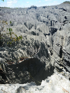
We left Madagascar
from Baly Bay, just north of Cap Saint Andre, on October 13 and arrived in
South Africa at Richards Bay on October 20. We had several anchoring spots on
the Mozambique coast researched and plotted since most boats are not lucky
enough to get a weather window long enough to make the entire trip non-stop.
The planned passage covered 1113 miles in seven days. Here are more details
about our planning and experiences:
Planning
the Mozambique Channel Crossing
Cyclones became a
slight threat in northern Madagascar in November. South Africa was warming in
the southern hemisphere Spring season and temperatures there were becoming more
suitable for us. Some cruising boats made the crossing a month or two earlier
and they encountered chilly air and somewhat stormy conditions. Jimmy Cornell's
"World Cruising Routes" says the best time to go down this channel is
October-November. Some South African cruisers also recommended leaving in
November. We decided to leave Madagascar early before any chance for a cyclone.
The Agulhas Current
is famous for its strength and for the tremendous waves which can be produced
by winds blowing from the south against it. This current becomes important
south of Madagascar's latitude, near the end of the passage to South Africa.
Directly west of Madagascar a fairly weak current of 1-2 knots runs northward
along the Madagascar side of the channel while the Mozambique Current of 1-3
knots runs southward near the African coast. Large ships apparently take
advantage of these currents by traveling north on the Madagascar side and south
on the African side.
Some cruisers chose to work slowly down the Madagascar
coast against the current as far south as Tulear but there were few secure
anchorages south of Cap Saint Andre and we did not see any advantage in that
route. We felt the best course was to sail west from Cap Saint Andre until we
passed north of Juan de Nova Island where we hoped to enjoy the south-flowing
Mozambique Current and then ride that down towards South Africa.
Typical winds along
the Madagascar west coast were easterly in the mornings, westerly in the afternoons
and seldom strong. This made for delightful coastal motoring in almost flat
water. This wind pattern extended out into the Mozambique Channel and affected
boats trying to sail the rhumb line from Cap Saint Andre to Richards Bay. The
combination of light and variable breezes plus a slight northerly current
resulted in very slow progress for some of those sailing boats. The two sailboats
that left with us had very slow going and were forced to stop in Mozambique and
wait. We had a forecast of several days
of light northerly winds when we started across the channel and we enjoyed flat
water for the first 4 or 5 days towards Africa. Tropical latitudes usually do
not have strong winds (excepting squalls and cyclones) so we had no worries
about winds in the northern part of the Mozambique Channel. Below the Tropic of
Capricorn the winds were often stronger. Low and high pressure systems constantly
moving from west to east across southern Africa seemed to spawn fronts which
swept up the channel about once per week. Most important to avoid were strong
southerly winds blowing against the strong Agulhas Current.
Weather
Forecasts
We seldom bothered
with weather forecasts while cruising along Madagascar's northwest coast. Winds
there were almost always light, usually blew from the land in the morning and
towards the land in the afternoon, and waves were never large. When we needed
forecasts for the crossing to South Africa we obtained GRIB files through Airmail
and listened to SSB nets hosted by volunteers in South Africa. The passage from
Cap Saint Andre to Richards Bay was over 1000 nautical miles. Extended weather
forecasts for a week or more in the future were not accurate enough to insure
good weather for the last part of the passage, the part where wind strength and
direction was most critical for cruising boats. The best we could do was leave
with what appeared to be a good "weather window" and be prepared to
duck into emergency anchorages in Mozambique if the forecast changed.
The most-used SSB
weather net was "Peri-Peri" on 8101 khz at 07:00 and 17:00 South
African time (GMT + 2). The net controllers used BuoyWeather to get forecasts
for the locations of calling boats. Another valuable net was the South African
Maritime Mobile Net hosted by Graeme on 14316 khz at 8:30 and 13:30 South
African time but we never heard him with our lousy radio. We seldom called but often listened and found
the Peri-Peri net very useful. We were very grateful to the dedicated South African
volunteers who made sure weather information was available to cruising boats
every day.
Madagascar
to Africa
We raised anchor in Baly
Bay and left Madagascar at 3AM the morning of October 13. Lovina and Daemon were
going to wait for first light and be 3 hours behind us. The wind was a light,
as usual, and we headed out into deep water before turning west. Along the
coast we were bid a final farewell.
By midnight we were about 30 miles directly north of Cap Saint Andre and had already landed a 1 meter long Spanish mackerel and had enough fish for our passage.
Alternator Troubles
Unfortunately, a
gremlin returned with our main engine 200 amp alternator and once the batteries
were full, the alternator output started pulsing. I have a meter on my main electrical panel
that shows the alternator output and I could watch it swing back and forth from
100 amps to 0 amps. I suspected that it
was a failure of the “sensing” wire between the alternator and the batteries
but had no desire to spend extended time in the 130 degree engine room. We also carry a complete spare alternator,
but changing that underway was similarly not desirable.
Although this
condition was worrying, it was not critical since the batteries were remaining
fully charged. The main concern was that
these large current fluctuations were creating a lot of interference in my SSB
radio and I could barely hear any boats or weather nets more than about 200
miles away. Since my generator starting
battery is completely separated from the house and engine batteries, I ran some
temporary wires from the radio to the generator battery but saw no noticeable
improvement. Ultimately, we were unable
to get any weather GRIBs or send in position reports during this passage. We
figured that we could still talk to other cruising boats and would be able to
hear the African nets as we neared Mozambique.
Over the first two
days we made steady progress and were able to speak daily on the SSB with Lovina and Daemon. We still had not found the helpful Mozambique Current, but
we also had no adverse current and we kept on moving. We were visited by leaping dolphins and
humpback whales and we fell into passagemaking mode. Emily even did a regular watch after dinner
until 9PM to shorten Kim’s normal watch.
Lovina and Daemon could not find good wind so they headed more westward and we slowly drifted apart and after 4 days we could not hear them anymore. We crossed the Tropic of Capricorn and continued southwest looking for helpful current. Two boats, Mojombo and Cats Paw, had left two days before us and as we caught up to them, we started communicating with them on the SSB. They had good radios and verbally relayed weather reports, and we all decided to push non-stop to Richards Bay. We passed our safe anchorages on the Mozambique coast and still had not found the Agulhas Current 60 miles off the coast.
Dirty Fuel
We had taken on
almost twenty 55 gallon drums of fuel in Madagascar over our stay there and
even though we had filtered it all, Tom noticed the vacuum gage on the primary
engine filter steadily rising (indicating the engine working harder to suck
through the dirty filter). We do have
two filters installed and simply changing two valves, we switched over to a
clean filter and all was well for a few hours.
This secondary filter housing, however, must have a small air leak and
we were getting air into the fuel that would cause the engine speed to surge as
the air moved through the engine. Tom
managed to remove the old dirty filter, install a new one with the engine
running in the 130 degree engine room in record time. Unfortunately, enough air got into the fuel
line and the main engine died. The seas
were relatively calm still, so Tom managed to re-prime the main engine and get
her running again quickly. He still
carries a burn on his priming finger from the hot metal pumping handle on the
engine-mounted priming lever!
Finally just south of
Caldiera Island and only 20 miles from the coast, we started to fly. Most of the next 2 days we had more than two
knots of current and had speeds over ground of 7, 8 and 9 knots. Emily had fun watching our boat speed go past
10 knots as we surfed down some of the steeper following seas.
As we got closer to Richards
Bay, the seas got bumpier and more confused although not too big. The last 20 miles were really bumpy as we had
25 knots of wind on the nose. We snuck ahead of both Mojombo and Cats Paw even
though they had left 2 days ahead of us.
Before entering
Richards Bay it was necessary to call Harbor Control on VHF channel 12 (or 16)
and ask permission to enter. They controlled movement of large ships in and out
of this port. We were told it was the largest coal exporting port in the world,
also exported large amounts of aluminum, chrome and wood chips and accounted
for over half of all South African shipping. On October 20th at
11AM, we motored to the International Dock area of the small craft harbor guided
by friends on Erica who heard us on
the VHF and guided us in. We did not
have long to wait for official clearance. Immigration and Customs officials
arrived later that day to quickly clear us into South Africa with three-month
visas. It was very nice to deal with professional officials who charged no fees
and asked for no "gifts." We then moved into the Tuzi Gazi marina to
take care of business, enjoy good Internet and telephone services, and begin
our visit in Africa.
We had some outboard
motor parts and a new mileage flag from the Nordhavn folks waiting for us at
the marina. Monkeys scampering across
the docks gave us a hint that we are not in New England any more…
Tom


